DT25 | Geopolitical Update of Northern Chile
This article was translated automatically and may contain differences from the original. For reference, read the original.
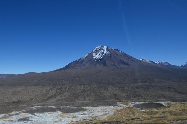
Focusing on the regions of Arica and Parinacota and Tarapacá, this document provides a description of their geographical characteristics and analyzes their geopolitical situation to draw conclusions about, for example, the weakening of sovereignty, the absence of a strategic vision from the State, and the need to improve bilateral relations with neighboring countries.
The deterioration of security in Chile has been progressive, but with greater intensity in the northern part of the country. An increase in high-profile crimes, as well as others to which citizens were not accustomed, has been compounded by the emergence of foreign criminal gangs in cities such as Arica and Iquique. Similarly, the precarious border control in the north was highlighted by the massive influx of immigrants entering the country amid the State’s inability to regulate them, in an extremely porous border. Over time, measures were implemented to alleviate this situation, which necessitated the use of military means, but worsened the perception of citizen security.
The weakness of the State, evidenced by its inability to exercise effective full sovereignty, has become apparent in the fragmented, incomplete, and uncoordinated actions of its institutions, with massive illegal occupations of public lands, a growing depopulation of the national highland area, and an increase in criminality, among other factors. All of this is further complicated by the fact that this area of national territory has a peculiar topography, where there are significant shared water resources and a land border with two States.
The regions of Arica and Parinacota and Tarapacá have particularities that make them strategic areas. Their location, characteristics of their border, economic importance, among others, assign them geopolitical value that must be addressed. Due to these singularities and the events observed in northern Chile in recent years, there arises the need to conduct a study that analyzes the situation and examines the area, thus proposing an updated geopolitical vision of what is happening, identifying risks, threats, and opportunities for national interest.
This work will cover two regions: Arica and Parinacota and Tarapacá. Throughout it, a description of the main geographical characteristics of both will be provided. Subsequently, an analysis of the situation will be developed from a geopolitical perspective, with the aim of identifying factors that relate to and evidence the state weakness in the mentioned regions, such as issues arising from the free transit granted to Bolivian goods or the situation of shared water resources. The work will then focus on drawing conclusions about the weakening of sovereignty, the absence of a strategic vision from the State, the geopolitical importance of the area for Chile, and the need to improve bilateral relations with neighboring States. Finally, this study will concentrate on identifying risks, threats, and opportunities for the country, as well as proposing measures to address or mitigate the problems.
To carry out this analysis, AthenaLab traveled to northern Chile to conduct a ground and aerial reconnaissance of the area, as well as to interview authorities and citizens, which was complemented by geographical study and the gathering of bibliographic data. The field visit included reconnaissance of the coast, border areas, the highlands, and the main cities. The AthenaLab team consisted of Fernanda Muñoz, John Griffiths, Marcelo Masalleras, and former ambassador Gabriel Zepeda, along with Pablo Blanco, Sebastián Gaete, and Nelson Cartes, crew members of the Airbus H-145 helicopter.