Millions of square kilometers of Chilean Austral in the constitution
This article was translated automatically and may contain differences from the original. For reference, read the original.
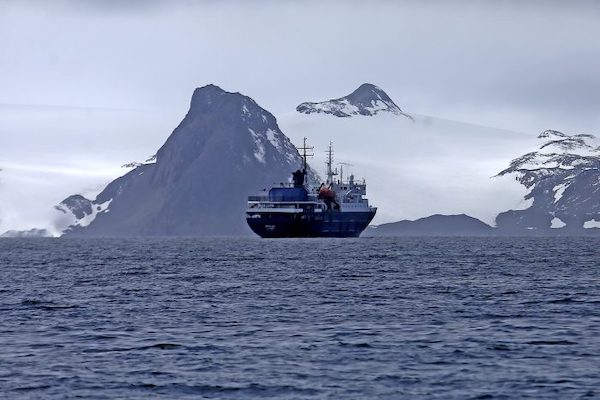
To understand the material importance that the southern territories hold for the future of the Chilean people as a whole, it is useful to point out that the region of Magallanes and Chilean Antarctica—measured from the Southern Ice Field to the Cape Horn Archipelago (longitudinally about 700 km or the distance between Santiago and Temuco)—covers an area 8.5 times larger than that of the Metropolitan Region.
El Mostrador, February 9, 2022
Various popular initiatives aimed at achieving the constitutional recognition of the country’s terrestrial, insular, maritime, and polar territories have been presented for discussion by the Constitutional Convention. Attracting a large number of subscribers, all of them illustrate interest in a significant issue that, although ignored by previous constitutionalists, reflects society’s concern for sustainable use and conservation of the natural resources of our geography.
This is the case of, first, our underwater sovereignty in the Southeast Pacific (from the “triple union” of the Taitao Peninsula in Aysén to the tectonic plates of Rapa Nui, Sala y Gómez, San Félix, and San Ambrosio off the coast of Atacama); second, the unresolved issue of boundaries in the Southern Ice Field; and third, the challenge associated with the Argentine claim to territories in the Southern Ocean beyond what was agreed upon with Chile in the Treaty of Peace and Friendship of 1984. Related to this last point is also the issue of continental shelf claims presented by Australia, Norway, France, South Africa, and Argentina within the area governed by the Antarctic Treaty System.
These circumstances deserve our attention and concern both for the diplomatic and security challenges they represent and because, from an alternative perspective and in accordance with the law, they constitute opportunities to reinforce the logic that supports the geo-legal thesis of the continuity and integrity of our territories from Visviri to the South Pole, and from the Andean peaks to Rapa Nui.
In the case of our territories in “the southernmost part of the planet,” this concept encompasses geographies up to and beyond 200 nautical miles, including the underwater territories located between the so-called “Point F” of the Treaty of Peace and Friendship (approximately 260 km south of Cape Horn) and both coasts of the Chilean Antarctic territory. This refers to the Chilean sector of the Southern Ocean known by the anglicism “Drake Passage.”
Various prospective studies include that part of Chilean territory among the most coveted spaces for foreign geopolitical and geo-economic ambitions, as it literally comprises millions of square kilometers that, on one hand, harbor enormous volumes of living and non-living natural resources and, on the other, constitute the southernmost interoceanic route, whose strategic value is evident in the context of the “new cold war” between the West, China, and Russia. A similar phenomenon is occurring in the Indo-Pacific sector of the Southern Ocean, a political and geopolitical phenomenon that includes the revaluation of maritime passages between the Indian and Pacific Oceans, which has motivated a novel alliance between India and Australia.
To understand the material importance that the southern territories hold for the future of the Chilean people as a whole, it is useful to point out that the region of Magallanes and Chilean Antarctica—measured from the Southern Ice Field to the Cape Horn Archipelago (longitudinally about 700 km or the distance between Santiago and Temuco)—covers an area 8.5 times larger than that of the Metropolitan Region. This is an area equivalent to the size of Nicaragua or Greece, and even larger than that of North Korea. If we add to this area the projection of the exclusive economic zone and the legal continental shelf (200 miles), it is evident that the Magallanes maritime territory alone has at least 400,000 km², which, when combined with the land area, makes Magallanes (excluding Chilean Antarctica) a total area of approximately 540,000 km², equivalent to the land area of France.
If we add our Antarctic possessions to this vast territory—estimated from the aforementioned “Point F” of the 1984 Treaty and between longitudes 53º and 90º (Antarctic Decree of 1940 and Antarctic Statute 2021)—we find that, using International Law, south of that point our country can consider as its own an area of at least 3.6 million km², composed of the Chilean sector of the Southern Ocean and our Antarctic land: a space even larger than the surface area of India.
This entire vast territory consists of several sectors that, for reasons of geographical and political coherence, it is advisable to distinguish. Namely: first, the Chilean sector of Patagonia (“land of the Patagonians” north of the Strait of Magellan, only); second, the Strait itself (a biogeographical, geo-economic, and geostrategic unit in itself); third, the Chilean sector of the Fuegian Archipelago (Province of Tierra del Fuego, a region distinct from Patagonia); and fourth, the insular, oceanic, and polar regions that open toward the Antarctic Pole from the Beagle and Cockburn channels.
Because this last sector of Chile includes “all the islands south of the Beagle Channel,” in our political-administrative division, that territory corresponds to our Antarctic province with its capital in Puerto Williams.
This is a “new-new southern world” that, importantly, among the islands of Cape Horn and the Beagle, has been inhabited since time immemorial by some of our indigenous peoples (occupation, use, and control of space).
All neighboring countries have incorporated explicit references to their territories in their respective Political Constitutions. Chile has yet to do so.
This not only undermines the concept that citizens themselves have of the geographical assets that belong to them, but also facilitates situations in which, in the application of certain laws and policies, specific public services may have doubts and hesitations about, for example, understanding that a trip between Punta Arenas and any of our Antarctic bases is not an “international trip” but simply a domestic trip within the region of Magallanes and Chilean Antarctica.
The constituents then have the opportunity to resolve the issue by including in the new Constitution a clear and precise definition of the extent of our terrestrial, insular, oceanic, and polar territories. Thus, in the future, public policies (including educational policies) will have a concrete geographical reference upon which any state action must be realized to intelligently and sustainably occupy, utilize, and value all our geographical assets.
Jorge Guzmán
Researcher at AthenaLab