DE1 | The Maritime Authority: Its Roles in Rivers and Lakes and Its Relationship with Environmental Issues
This article was translated automatically and may contain differences from the original. For reference, read the original.
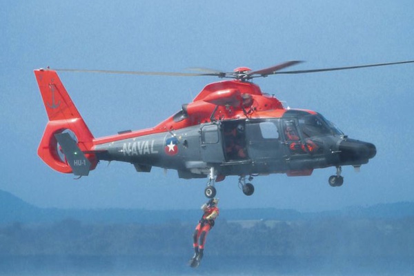
Chile has a coastline that extends for 4,300 km and a maritime territory[1] covering an area of 3,464,462 km², forming a tri-continental reality in America, Antarctica, and Oceania. This space, which is no less than 4.5 times the land territory, is the sea over which the State of Chile exercises sovereignty or jurisdiction, depending on the regime of the maritime zone, having the obligation and responsibility for its surveillance, control, and protection.
Throughout its history, our country has assumed responsibilities before the international community through protocols, agreements, and treaties in high seas areas of its interest, where it maintains a presence, encompassing the protection of human life, good order at sea, control over illegal fishing, and the preservation of the aquatic environment, among other responsibilities.
It is important to note that the maritime scenario is much larger and more varied than just the jurisdictional geographic areas and those spaces of responsibility assumed before the international community. This reality must also include the number of bodies of water that make up the navigable lakes and rivers of the country, over which the maritime authority exercises its functions and for which users demand services from the National Maritime Service.
Furthermore, due to the significant increase in private activity in rivers and lakes in recent years, it has become necessary to adopt a series of specific policies and procedures for the application of the current legal regulations, both regarding the determination of navigable rivers and lakes under the authority of the maritime authority and those that may be granted maritime concessions by the Ministry of National Defense through the Undersecretariat for the Armed Forces.
Article 6 of D.F.L. No. 292, of 1953, on the Organic Law of the General Directorate of Maritime Territory (Directemar) and Merchant Marine, establishes that this agency is responsible for exercising its jurisdiction over public domain lakes and navigable rivers up to the extent of tidal effects, and Supreme Decrees No. 11 and 12, of January 15, 1998, along with establishing the list of navigable lakes and rivers for vessels over one hundred gross tons[2], determine that it is the responsibility of the General Directorate to propose to the Ministry of National Defense, Undersecretariat for the Armed Forces, the inclusion of any other body of water that, according to the corresponding technical studies, meets the conditions for its inclusion in these lists.
However, the work carried out by Directemar is practically unknown to many Chileans, especially when it comes to navigable rivers and lakes. Probably, the information presented below is not commonly known, even among those who are familiar with the subject and understand the legal framework and the actions of the Navy in Chile.
For this reason, this document aims to explain and disseminate the actions of the maritime authority, highlighting the role of this institution as custodians and responsible parties for the environment, both at sea and in inland waters.
[1] The maritime territory includes the Territorial Sea, up to 12 nautical miles; the Contiguous Zone, up to 24 nautical miles; and the Exclusive Economic Zone (EEZ), up to 200 nautical miles (370 km).
[2] Annexes “A” and “B” include the list of navigable lakes and rivers for vessels over 100 gross tons.